Here are the thumbnail-sized pictures. Click on a picture to see
the full image. (Beware, they may take some time to download over a slow
connection.)
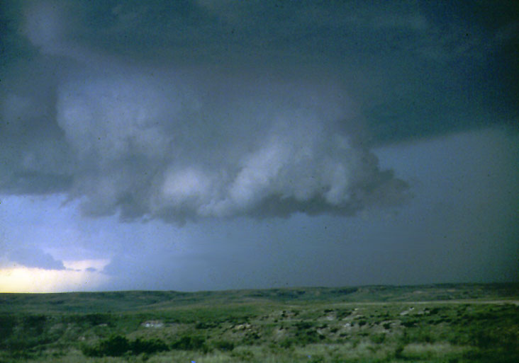
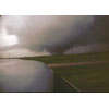
Photo of a roll cloud. High winds
drive a lower portion of the storm ahead. The winds can be quite
strong and have sometimes been confused as a tornado.
|
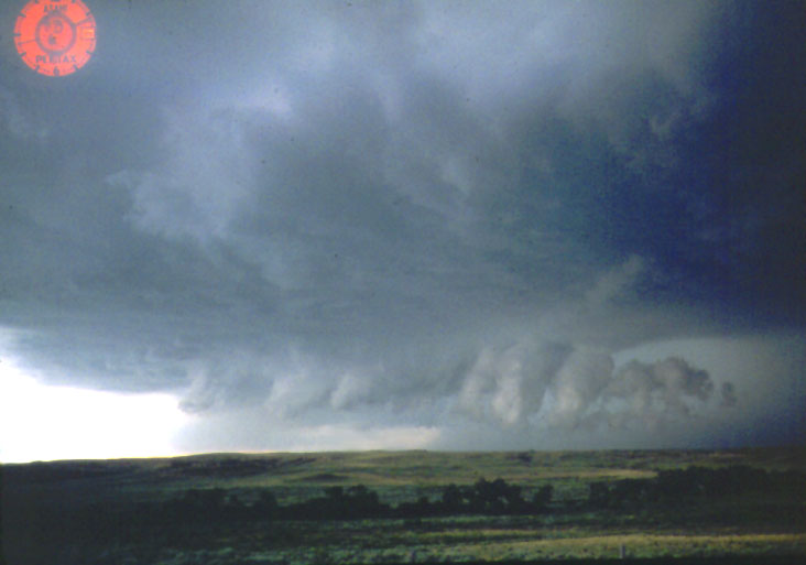
Photo of a gust front.
These very high winds immediately precede a severe storm.
The winds can be quite
strong and have frequently been confused as a tornado.
|
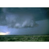
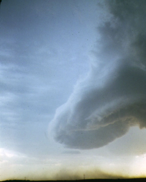
Photo of a wall cloud.
Tornadoes are typically formed at the back edge of a wall
cloud. This cloud is a central feature of a severe storm. It is the central,
lowered portion of a mesocyclone. This cloud is distinguished by its
sharp detail, lowered aspect, and fairly rapid rotation.
|
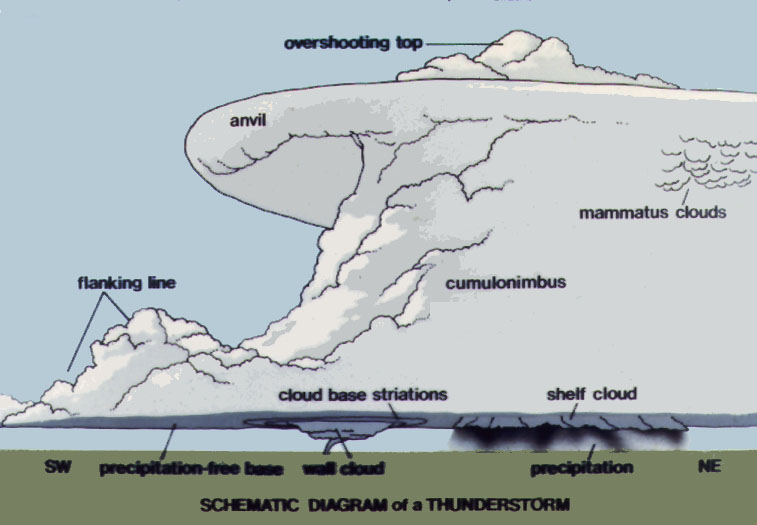
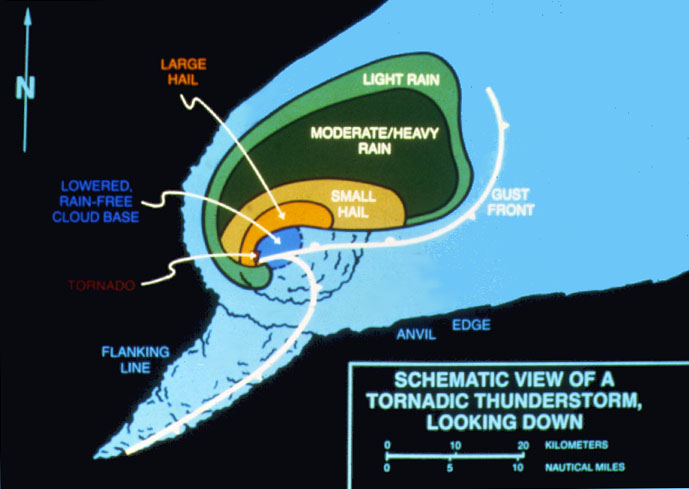
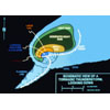
A schematic view
of a severe storm.
|
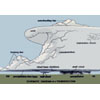
A bird's eye view
of a severe storm.
|
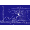
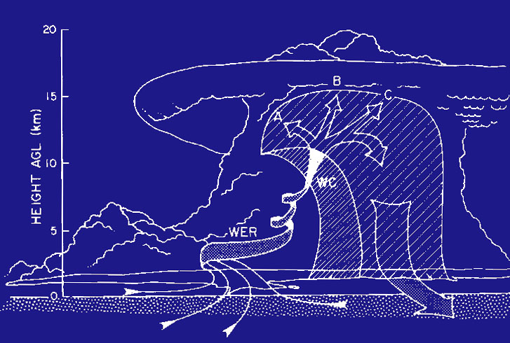
A schematic view
of the wind directions and motion of a typical severe
tornadic storm.
|
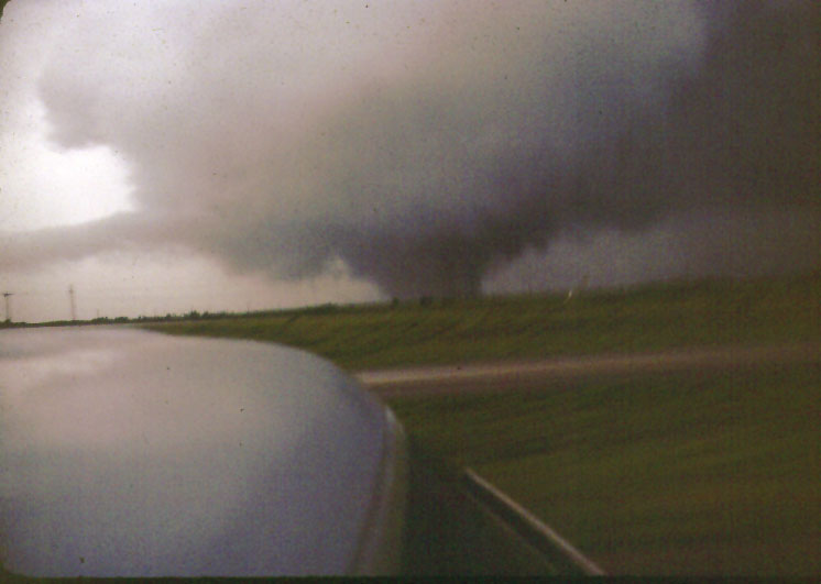
What most people
think of when they visualize a tornado.
|
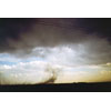
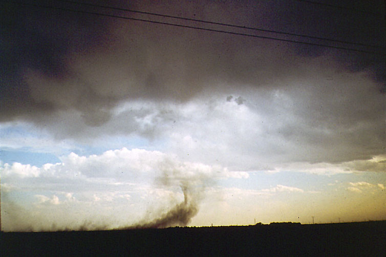
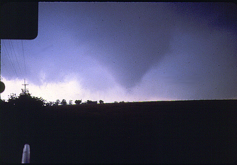
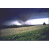
A newly forming
tornado kicking up dust from a field.
|
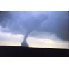
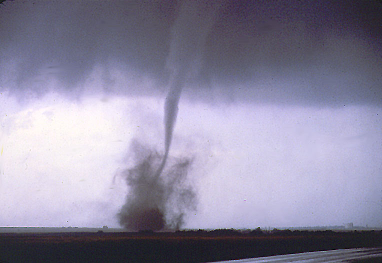
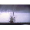
We photographed many
tornadoes of this type: single thin, highly mobile funnel.
|
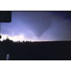
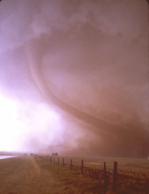
Another v-shaped
tornado.
|
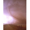
Here, the debris
cloud is quite high, reaching over 1000 feet.
|
Yes, the tornado is
indeed red! This tornado actually posed for us for a few
seconds before moving off. The red color is caused by the tornado picking
up dirt from a freshly plowed field that contained a large amount of
clay.
|
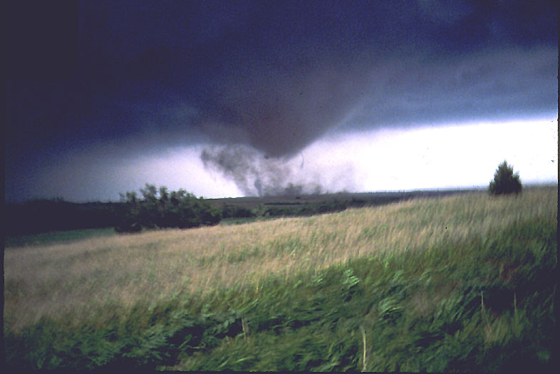
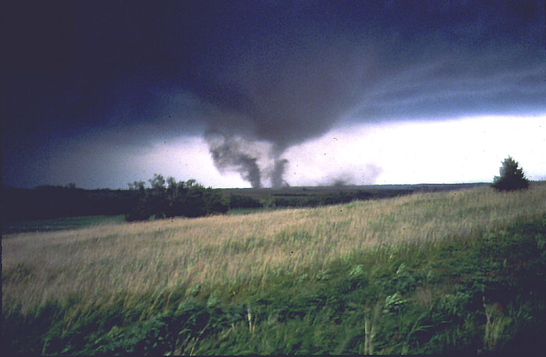
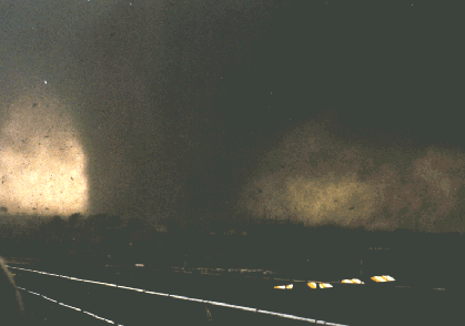
These three photos
are from a highly destructive tornado. It actually became multiple
tornadoes all rotating around each other. This photo shows an early
stage. Note the flattening of the grass in the foreground. We were over
1/2 mile away and it was difficult to stand up due to the force of the
wind.
700 followers instagram prada panier bag chatgpt api github yokohoma prada instagram followers 100 prada swimwear what are print concepts prada black clutch prada diagramme light up as if you had a choice lyrics ugg outlet prices extra large cork board places to eat rosemont il green prada glasses 必应 chatgpt yacht cap 50k followers instagram adidas prada superstar sapatos gucci prada leather sandals instagram 100 followers hair punch graphic design jobs erie pa anguish (1987) buy prada escada outlet chatgpt on iphone outlet sale online random instagram followers adidas prada superstar prada kids shoe medium brown wig cap prada gift cards designer glasses prada prada canvas sneaker prada claw clip chatgpt alternative reddit red prada handbag prada swirl sunglasses elements construction tommy hilfiger factory stores prada bifold wallet prada nylon hat tod's outlet store prada cream bag outlet mall online chatgpt cli prada jeans women iko nordic shingles prada pr08ys cardinal building materials large pin boards builders supply st louis soffit form medium brown wig cap dr patel house tampa ferragamo shoes outlet prada thunder sneakers prada zipper prada second hand cahier prada bag igfamed.com instagram followers prada compact wallet chatgpt architecture prada downtown bing chatgpt waitlist gucci america inc pennsylvania prevailing wage frequently asked questions price prada shoes yachting cap chatgpt video amused bouche tshirt prada vintage prada dress popular prada bag chatgpt real estate prada australia travel agent slogan chatgpt api github nakrutka instagram followers glue on beard chatgpt client carlucci's italian restaurant menu fake prada bags instagram followers service prada bauletto bag pink prada hat
|
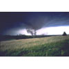
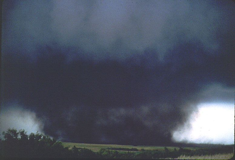
A few minutes
later, the tornado is taking shape.
|
In about 5
minutes, we were witnessing a huge tornado over a mile across.
|
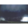
Contibuted by Ben Rothe, photo credit: Bob Dunn. F4 Tornado which struck Omaha Nebraska on 06 May 1975 with over $1 billion in property damage.
|